This section outlines how to populate spreadsheets using point data with eastings and northings or latitude and longitude coordinates.
- Download the Template spreadsheet for your activity (see 4.2 Download templates)
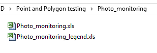
- There will be two spreadsheets in the folder – one for the actual template, and one titled ‘_legend.xls’. Open the template file (the one without ‘legend’ in the title).
- Your spreadsheet will contain a number of columns corresponding to the fields in your Activity. Fill these out, making reference to the ‘_legend.xls’ for the requirements for each field (see 4.3.1 Data Validation for Template Spreadsheets for more information on this).
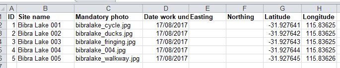
- If you have images you would like to include, enter the file name of the image, including the file extension (e.g. “bibralake_ducks.jpg”). These images will need to be in the same folder as the template shapefile to be zipped together for upload (see 4.3.2 Preparing your template spreadsheet for upload).