Skip to content
GRID
An easy-to-use, online GIS for Natural Resource Management groups
Home
Overview
Guide
Release notes
Wish list
Contact
Home
User Guide
1. Introduction and Sign In
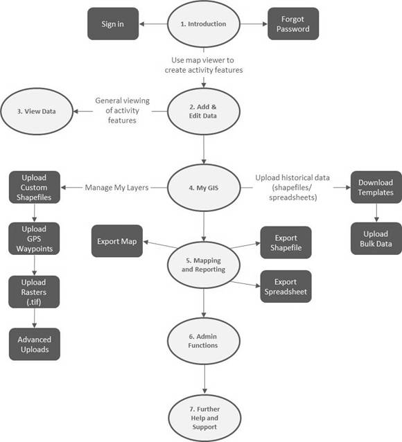
1.01 Chapter selection
1.01 Chapter selection
PREVIOUS
NEXT