In the interactive map navigate to the area where you would like to capture an activity by:
- Using the navigation tools found in the top right corner of the map (hover over an icon for a description of the tool). These tools are:
 Pan Map.
 Select Feature (note that you can only use this tool on activities already selected from the dropdown lists – see 2.1 Select your Project and Activity).
 Show Info (works on all features).
 Show Fullscreen.
 Zoom In and
  Zoom Out.
- You can also click and hold on the map to pan and use the scroll wheel to zoom in and out.
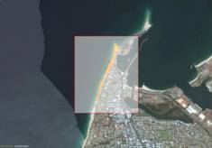
- Hold the SHIFT key down and click to drag a zoom square over your area of interest:
- Use the Search box to search for specific attributes within a feature (this will search all fields within an activity – i.e. “Site Name” or “Property Manager” but does not search Baselayer fields).

- Enter specific coordinates of a known area:
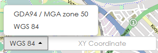
- Select your preferred CRS from the menu (located at the bottom of the map):
- Click in the XY Coordinate
- Type your coordinates and press ENTER.
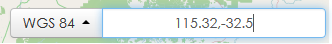
NOTE: The zoom extent will not change from its current extent.The map will pan to the specified coordinates.
- Select your preferred CRS from the menu (located at the bottom of the map):
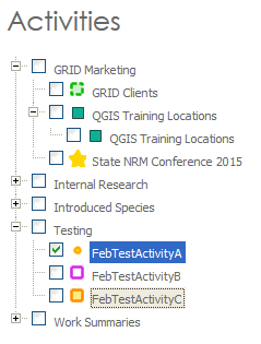
- For an existing Activity you can double click on the activity in the menu and the map will zoom to that layer extent.